THE WILSON SITE ( BjFu-2) AND
AREA
by
Jean-François Beaulieu
(jeanfb@sympatico.ca)
Introduction:
I first identified the area; as a potential
archaeological
site while researching on the former wharves of Prescott-Russell in
1995.
The aim of the survey was to locate the wharves and mills.
On June 22nd 1996 an archaeological survey
took
place near the village of Cumberland by an Ottawa Chapter OAS survey crew
consisting of Helen and Peggi Armstrong, Marian Clark, Bill McLellan,
Jim
Montgomery, Jean-Luc Pilon and myself . The surface inspection resulted
in the location of former wharves and mills.
Location:
The surface inspected area is located along
highway
174. Its consists of four waterfront properties were surface inspected
and more than 32 features were found. The properties mostly belong to
the
Wilson family and the Municipality of Cumberland.
Historical Background:
The land, wharfs and industrial complex belonged
to Mr.William Wilson, general store merchand, grist mill, granaries,
saw
mill, woollen mill, wharfs owner, and co-owner of Diamond Match factory
near one of the wharfs. Mr. Wilson was a prominent figure one of the
major
entrepreneur of Cumberland village. The area was used between
circa.1860's
and the early 1890's. A first wharf built in 1860s, was still present
in
1879. The grist mill and saw mill were present in the early 1880s. A
dirt
road, known as the Sarsfield / Bear Brook Road lead to the second wharf
westward, from 1880s to December 13th, 1905.
In early 1890's, Mr. WIlson's sons Charles and
George relocated the mills beside the actual ferry landing (the former
Cameron wharf location).
Environmental Settings
The waterfront properties has slopes going
towards
the Ottawa River. A dry creek was observed near the Allowance Road lot.
The area where grist mill remains were observed is located in a gully
near
the waterfront. The area has bushes and trees.
Methodology:
The surface inspection of the Allowance Road and
part of lot 13, subdivision lot #4 and# 5 has revealed the presence of
wharves and mills architectural remains. A survey was done on lot #5.
Some
artifacts were also plotted and collected. Transit stations were
established
A,B,C, and D. Some features were later basically plotted and mapped.
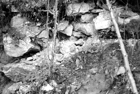
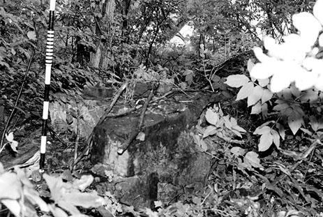
Findings:
The surface inspection of the Allowance Road lot
and part of lot 13 has revealed a heavy assemblage of concrete slabs
rubble
with tie rods , also known as foundation rods, which could be the
foundation
remains of a mid 1880's woolen mill.
The inspection of subdivision lot # 4 has
revealed
four features, consisting an embankment and foundation wall of a second
wharf built in the early 1880's, more of concrete slab rubbles with tie
rods.
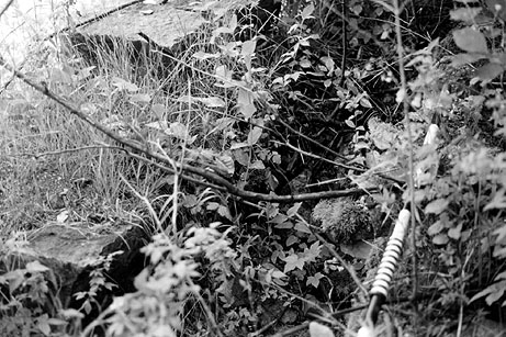
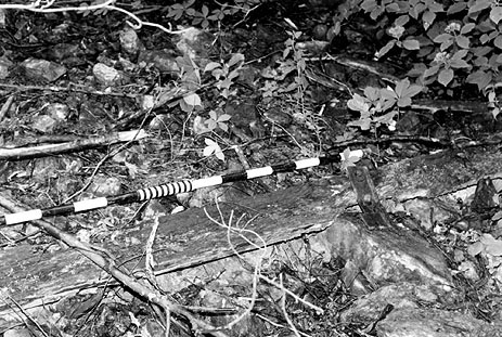
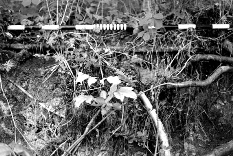
The inspection and survey of subdivision lot
#5
has revealed 28 features: one of them is the probable remains of a first
wharf embankment built in circa 1860's still present in circa.
1879.
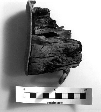
The other observed features are the remains of grist mill and a granary
built in the early 1880's. The wharf embankment area was later reused
for
a grist mill. The waterfront area has architectural features such as
wooden
beam, a pebble floor, rectangular block and a heavy assemblage several.
bricks and stones rubble, plaster rubble, were observed. Other features
such as walls, timber
beam
with bolts on a wall, miscellaneous hardware ( foundation rods,
steam pipe, tie bolts, etc.) , a stone
platform (which
could have been a chimney base or a machinery platform) were also
observed
along the waterfront. The area has two wooden beams and foundation rods
used to support a steam engines. Another wood remain were observed on
top
of a rises. These features can be associated with a grist mill.
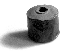
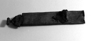
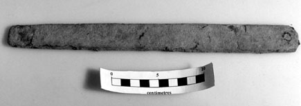
Artifact Analysis:
During the inspection 24 surface artifacts were
found
and collected consisting mainly of:
Thirteen (54%) Architectural Class Artifacts :
-
Eight bricks: one common red brick with
mortar, and
seven fire bricks, one identified as clinker fire brick with hardware,
possibly an anchor brick. Six others buff coloured with brand names
were
dated from the late 19th C. Four firebricks with brand name were
imported
New Castle Upon the Tyne area. Two other firebrick had with parts of
brand
names. The Fire bricks were used for chimney, boiler cradle and steam
engine
foundations.
-
Five Hardware: 4 flat metal sheets fragments
dated
late 19th century used for roofing, and one cut nail (datable to the
late
19th C.) were collected.
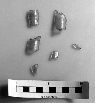
Eight (33.3%)Household Class Artifacts:
-
Two Ceramics: one ceramic bottle identified
as late
19th C. salt/ tin glazed inkwell.
Another ceramic
was identified as an exfoliated white refine earthenware with blue
transfer
pattern.
-
Six Medical Glass: 6
aqua
medical glass bottle fragments:one was identified as Castor Oil
Bottle
finish dated to the circa.1880's. Two others possible necks fragments
and
three currently unidentified.
Three(12%) Arms and Activity Class Artifacts:
Summary and Conclusion
The 1996 surface inspection and survey of the
Wilson Properties and the Allowance Road area waterfront confirm the
presence
of wharves and an industrial complex during the late 19th century.
For further information please consult,
Jean-François
Beaulieu,
The Wilson Site BjFu-2 and area Licence Report # 96-070
on file at the Ministry of Culture Tourism and Recreation.
Additional information about other wharf installations and their
role
in the development of commerce in Prescott & Russell Counties of
Ontario
can be found at the following Web site by Jean-François Beaulieu: The
Forgotten Wharves of Prescott - Russell.
BACK